Sunday, January 31, 2016

Starting Up Bicycle Commute After 2 Feet of Snow

Snow, Washington D.C., car
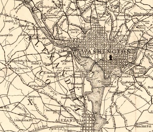
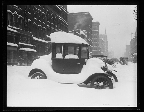
Snow in Washington DC, January 1922 (from the Library of Congress)

Last weekend two feet of snow (give or take) fell from the sky, closing the government completely for several days, then various kinds of delayed arrival and the like through Friday. I teleworked through Thursday, returning to work on Friday - using Metro.

I am not crazy about using Metro, but I didn't feel like experimenting with the snow on the trails that day.

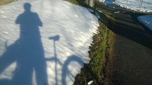
Yesterday, Saturday, I went about a third of the way to work, to see what conditions are like on the bike trails between my house and the Potomac river where I cross the 14th street bridge into DC.

Plowed trail Arlington County VA
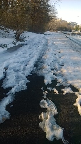
Bicycle trail plowed by Arlington County

The trail for about a half mile from my house to the Four Mile Run Trail was not plowed, but it was mostly clear anyway. The Four Mile Run trail near Shirlington was plowed, continuing on in all the way to the Potomac near the south end of National Airport. Arlington County uses a Gator or something similar; it is difficult for them to stay on the trail consistently, as you can see by the tread marks in the grass where the small plow was off the trail for a while.

Mt Vernon Trail near south end National Airport
Mt Vernon trail near south end of National Airport

Once the trail leaves Arlington County and runs into the Mt Vernon trail, the plowing stops, and the conditions are much more mixed - that is, there is more snow and ice. I can route myself through Crystal City to avoid some of this; I'll see how it goes tomorrow.


Sunday, January 3, 2016

1896 Bicycle Map for DC and Area

Roberts' [bicycle] road map of the District of Columbia and adjoining portions of Maryland and Virginia.

Cover title: Bicycle road map : Roberts' road map of the District of Columbia and adjoining portions of Maryland and Virginia : with tables of distances ... character of roads.
Created / Published - Washington : W.F. Roberts, c1896
Library of Congress, Geography & Map Division
http://lccn.loc.gov/88693356

Roberts Bicycle Map Washington DC and area 1896
Click here for zoom view of this 1896 map

Roberts Bicycle Map Washington DC and area 1896 - detail
Detail showing Washington DC and then-Alexandria (not Arlington) County

Roberts Bicycle Map Washington DC and area 1896 - road quality
Indicators for quality of roads (for use by cyclists)

Roberts Bicycle Map Washington DC and area 1896 - Rides in VA
Runs (ie, rides) into Virginia from downtown Washington

Distances are from the U.S. Treasury Department building and not the U.S. Capitol.

I found a similar, but not the same, map from 1896 published in the Washington Times that I blogged about.

Saturday, January 2, 2016

"Charmless" Signage in Arlington (VA)

I was reading a story in the Washington Post about changes coming to Arlington County council in the new year.

There is this, with a quote from Council member Libby Garvey: Garvey warned that local government should not “overstep our role and risk stifling innovation,” particularly in regulations such as the sign ordinance, which took more than a year to revise. “Part of the charm of Arlington,” she said, “. . . is how not standard everything is.”

I am not sure what "sign ordinance" is being referred to, but I don't much care for non-standard, inconsistent application of signage to traffic control affecting cyclists - but I don't have to go far to find some, given a recent change to the trail near my house.

Down the street from my house on South Dinwiddie Street, there is a trail that is an offshoot of the WO&D trail, that is parallel to the Lucky Run (stream).

Dinwiddie_WReed

The trail is shown in the image above, with the red line. Somewhat unusual I would say, there is a standard sidewalk and crosswalk at the intersection, then 40 or so feet back on S Dinwiddie, there is the crossing for the trail. It is not painted as a crosswalk with zebra stripes, but there are some dashed lines to show it is there to drivers. There are yellow yield signs controlling pedestrians and cyclists on the trail who would cross S Dinwiddie St.

Meanwhile, just a quarter mile away, the trail crosses S Wakefield St in a similar way but the traffic control is completely different.

Untitled

These stop sign appeared about a month ago - previously there was not signage here controlling pedestrians and cyclists on the trail where it crosses S Wakefield St. (Yes, the stop sign are not full size, but sort of toy size for some reason.) And the crosswalk is painted with full zebra stripes.

Wakefield_WReed

Here you can see the situation, much like at S Dinwiddie St, with the trail crossing set about 40 feet back of the crosswalk that is the intersection.

I don't understand how it is that Arlington County thinks these intersections are supposed to work successfully. In general, if a motorist sees me in the "not quite a crosswalk" for the trail crossing, they stop - but I can't count on it. And apparently at one of the intersections (Dinwiddie) I am merely to yield, but the other (with full zebra stripes!) requires a full stop! WTF, to use the vernacular (or vulgar - whichever).

Consistency in these matters could be a good thing, even in quaint Arlington County. This is a real safety issue, after all.