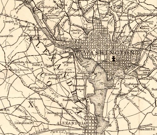
Cover title: Bicycle road map : Roberts' road map of the District of Columbia and adjoining portions of Maryland and Virginia : with tables of distances ... character of roads.
Created / Published - Washington : W.F. Roberts, c1896
Library of Congress, Geography & Map Division
http://lccn.loc.gov/88693356

Click here for zoom view of this 1896 map

Detail showing Washington DC and then-Alexandria (not Arlington) County

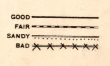
Indicators for quality of roads (for use by cyclists)

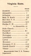
Runs (ie, rides) into Virginia from downtown Washington
Distances are from the U.S. Treasury Department building and not the U.S. Capitol.
I found a similar, but not the same, map from 1896 published in the Washington Times that I blogged about.
No comments:
Post a Comment