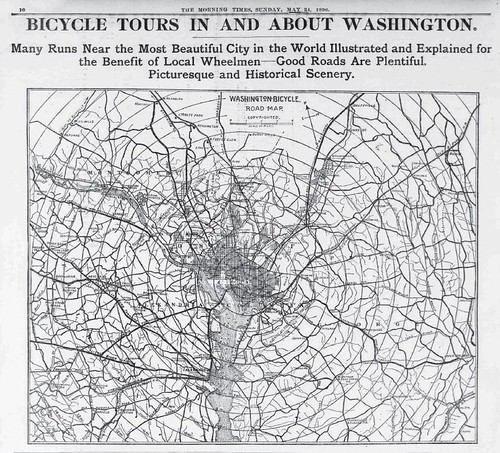
PDF of map for cyclists in the Washington DC Morning Times, May 24, 1896
The above "Washington Bicycle Road Map (presented in a newspaper) is one I like very much since it covers so much of the DC region - it reminds me that at that time, the growing popularity of cycling was about leisure riding and a significant part of that for long rides into the countryside (which would now be suburbs, mostly). The city was only around a quarter of a million people after all. The map extends at least 12 miles out in all directions from the center of DC.
No comments:
Post a Comment